A volcano in Indonesia has erupted, releasing a massive 54,000ft ash cloud, leading Australia to issue a red flight safety alert. Mount Seme...
A volcano in Indonesia has erupted, releasing a massive 54,000ft ash cloud, leading Australia to issue a red flight safety alert.
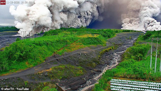
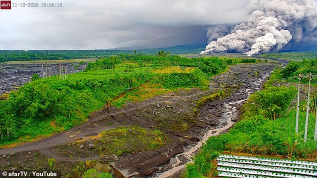
Mount Semeru erupted on Wednesday, prompting the nation's volcanic monitoring agency to raise the alert status for Java Island's highest peak to the maximum level.
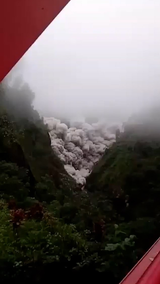
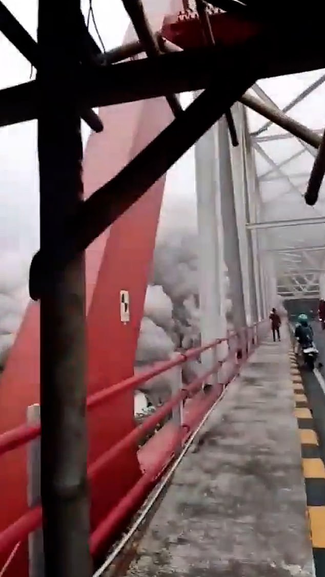
Australia's Volcanic Ash Advisory Centre (VAAC) issued a notice regarding the massive volcanic ash cloud, captured in striking video shared on social media by people fleeing for their safety.
"The ash column was seen as gray, with heavy density towards the north and northwest. At the time of this report, the eruption was still taking place," said Mukdas Sofian, an officer from the Mount Semeru Observation Post.
Mount Semeru is currently at Alert Level II, and the public has been advised to stay away from the southeastern region, particularly near Besuk Kobokan, within an 8km radius of the peak.
"Beyond that distance, the community should avoid conducting any activities within 500 meters of the Besuk Kobokan riverbank due to the risk of being affected by the spread of hot clouds and lava flows extending up to 13 kilometers from the summit," Sofian stated.
He also advised locals to stay outside a 3km zone around the crater to prevent exposure to any hot rock eruptions.
"The public is also encouraged to remain vigilant about the risk of hot clouds, lava flows, and lahars in rivers and valleys starting from the summit of Mount Semeru Volcano, particularly along Besuk Kobokan, Besuk Bang, Besuk Kembar, and Besuk Sat, as well as the possibility of lahars in smaller streams that flow into Besuk Kobokan," Sofian stated.
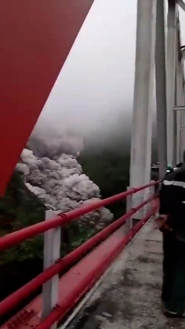
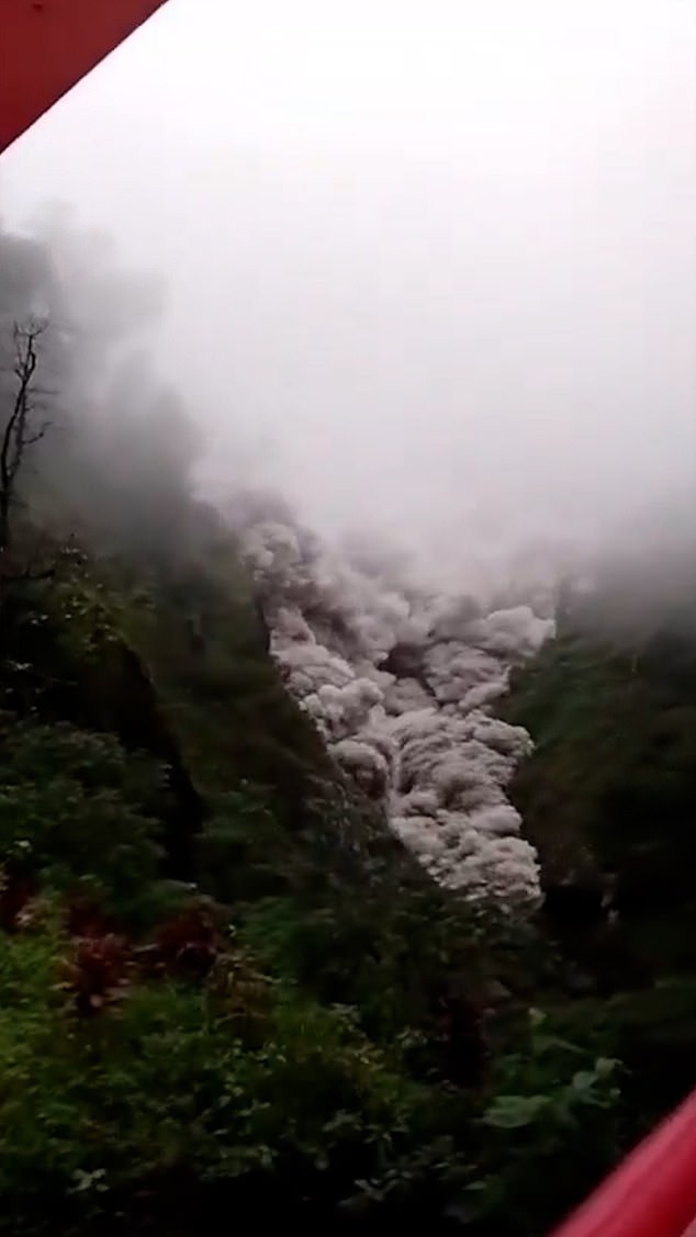
The volcano, located approximately 310 kilometers west of the popular tourist destination Bali, is thought to have erupted three times, with the initial one taking place at 4:10 am Western Indonesian time, resulting in a dense and gray ash cloud.
The volcanic explosion was captured on a seismometer, showing a peak height of 22mm and lasting for 142 seconds.
The mountain erupted once more at 5:09 am Western Indonesian Time (WIB), reaching a peak amplitude of 22mm and lasting for 150 seconds.
A third and last eruption occurred at 6:05 am. The ash cloud was seen to be white and gray, with a dense concentration towards the southeast and south.
"The volcanic explosion was captured on a seismometer, showing a peak height of 22 mm and lasting for 137 seconds," stated Sofian.
"The public is warned against participating in activities within an 8km area around the crater or summit of Mount Semeru because of the danger of being hit by flying rocks," said Muhammad Wafid, head of the Indonesian geological agency.
The geological authority also stated that earthquake activity at Mount Semeru continued to be intense.
No immediate accounts of injuries resulting from the volcanic explosion have been reported.
Airport officials at Ngurah Rai in Bali stated that flight timetables are running normally so far.
The volcano is located on the island that has the highest population density in the country.
It triggered a cascade of scorching clouds composed of hot ash and a blend of rock, lava, and gas that moved as far as 7km (4.3 miles) down the slopes multiple times from midday until sunset, according to Indonesia's Geology Agency.
The volcano's activity during the day covered multiple villages with falling ash, prompting officials to increase the alert level twice, moving it from the third-highest to the highest.
Semeru, also referred to as Mahameru, has experienced multiple eruptions within the last 200 years. However, similar to many of Indonesia's 129 active volcanoes, thousands of people still reside on its rich slopes.
A 2021 eruption of Semeru resulted in over 50 fatalities and destroyed more than 5,000 homes, leading nearly 10,000 individuals to flee for safety.
Semeru, also known as 'The Great Mountain,' stands as the tallest active volcano on Java, reaching an elevation of 3,676 meters (12,060 feet).
It lies at the boundary between Lumajang Regency and Malang Regency in East Java and is among the area's most lively volcanoes.
Indonesia, home to over 270 million inhabitants, lies across the 'Pacific Ring of Fire,' a region known for frequent seismic activity, where various tectonic plates converge, leading to numerous earthquakes and volcanic eruptions.
The East Java Regional Disaster Management Agency (BPBD) has relocated senior citizens from Pronojiwo District and Candipuro District, Lumajang.
In a translated written statement, the East Java BPBD mentioned: 'The Rapid Response Team (TRC) from the Lumajang Regency BPBD conducted patrols and assisted in moving the elderly to safer locations.'
The volcanic flow is still continuing, with a peak height of 40mm. The flow has extended 8.5km from the mountain's summit. The wind is blowing towards the north.
The Japan Meteorological Agency is examining if there is a chance of a tsunami after the eruption.
Read more- What unexpected developments occurred when Indonesia's Mount Lewotobi Laki-Laki erupted, creating a massive 10,000-metre-tall ash cloud, leading to the most severe alert level?


